Crime & Safety
Irene Hits Home [Updated]
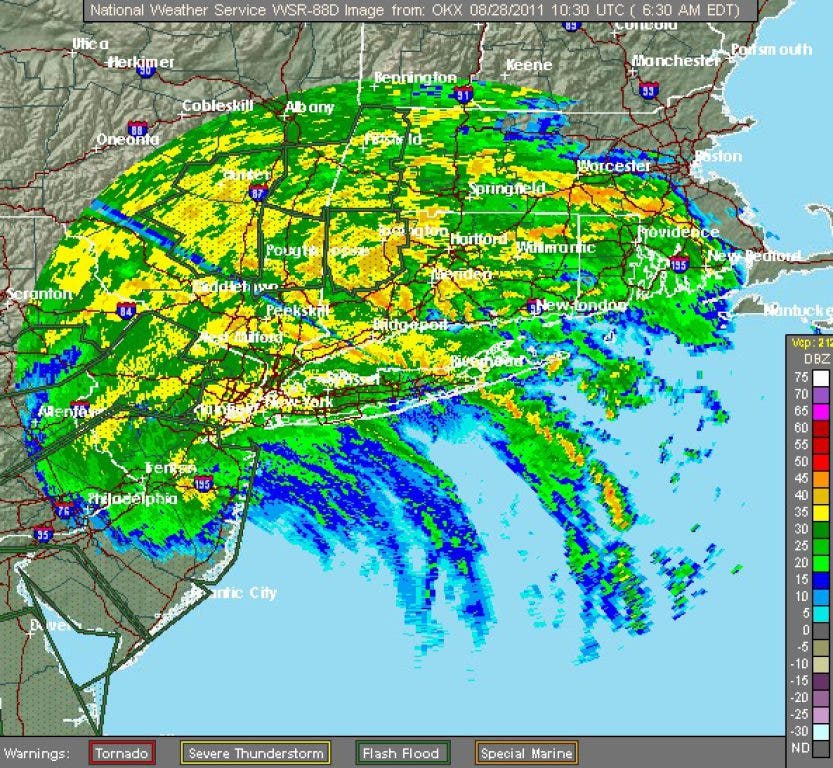
Storm has made landfall over New Jersey and its eye is headed for Connecticut next.

Update: 8:00 a.m.
As of 5 a.m., the National Hurricane Center had Irene as a weak Category 1 hurricane with maximum sustained winds of 75 mph. The storm is currently about 15 miles south-southeast of Atlantic City and moving north-northeast at 18 miles per hour.
Here were the latest reported numbers from Irene across the area as of 4 a.m.
Find out what's happening in Woodbury-Middleburywith free, real-time updates from Patch.
Peak Wind Gusts/Rainfall Totals
- Danbury, CT - 36 mph, 2.95 in
- Bridgeport, CT - 51 mph, 1.71 in
- Meridan, CT - 41 mph, 2.37 in
- Groton, CT – 39 mph, 0.69 in
- White Plains, NY – 44 mph, 3.1 in
- JFK Airport, NY – 59mph, 4.01 in
The center of circulation is still well off to the south and west and it’s the winds right around the eye which may be the most devastating. By mid-morning these winds will make it to our area.
Find out what's happening in Woodbury-Middleburywith free, real-time updates from Patch.
Please stay indoors and be safe as this is a very dangerous situation.
Update: 7:45 a.m.
CL&P is now reporting more than 250,000 power outages statewide and requesting that customers report their own at 800-286-2000 or cl-p.com.
Update: 7:00 a.m.
Governor Dannel Malloy has closed the Merritt and Wilbur Cross Parkways until further notice and instituted a tractor trailer ban on all roads in the state, effective immediately.
"The storm is beginning to make its way through the state, and there is absolutely no reason to be out on the roads" Malloy said in a release. "There are substantial concerns about driver safety and we need to keepthe roads clear for emergency personnel."
Original Story
Bending treetops to breaking and with a relentless rain, Hurricane Irene made landfall early Sunday morning in New Jersey and began making her way into Connecticut.
Both Fairfield and New Haven counties are under tornado watches until 11 a.m., in addition to standing hurricane and flood warnings, according to the National Weather Service.
As of 6:45 a.m. CL&P was reporting more than 170,000 outages around the state. This includes the following totals within our region:
- Bethel: 2,673 customers (32%)
- Brookfield: 487 customers (6%)
- Danbury: 1,441 customers (4%)
- Middlebury: 121 customers (3%)
- Monroe: 4,538 customers (57%)
- Naugatuck: 2,015 customers (5%)
- Newtown: 3,508 customers (32%)
- Oxford: 1,082 customers (20%)
- Southbury: 2,929 customers (29%)
- Woodbury: 234 customers (4%)
The company stated on its Twitter account that it had more than 800 crews standing by, waiting for the storm to pass.
Tropical storm conditions throughout most of Sunday are to be expected, with sustained winds between 45 and 55 miles per hour, with gusts of up to 65. Rainfall will be torrential at times and taper toward evening.
Get more local news delivered straight to your inbox. Sign up for free Patch newsletters and alerts.


